by Chuck Bailey, Professor, William & Mary
from the January 17, 2026 newsletter from The Nature Foundation at Wintergreen
(Edited here with text more closely incorporated with the illustrations.)
Devils Knob is Wintergreen’s highest mountain with its summit just a tad over 3,850 feet (1,175 m) above sea level. Two water storage towers and a communication mast are clustered around the highpoint.
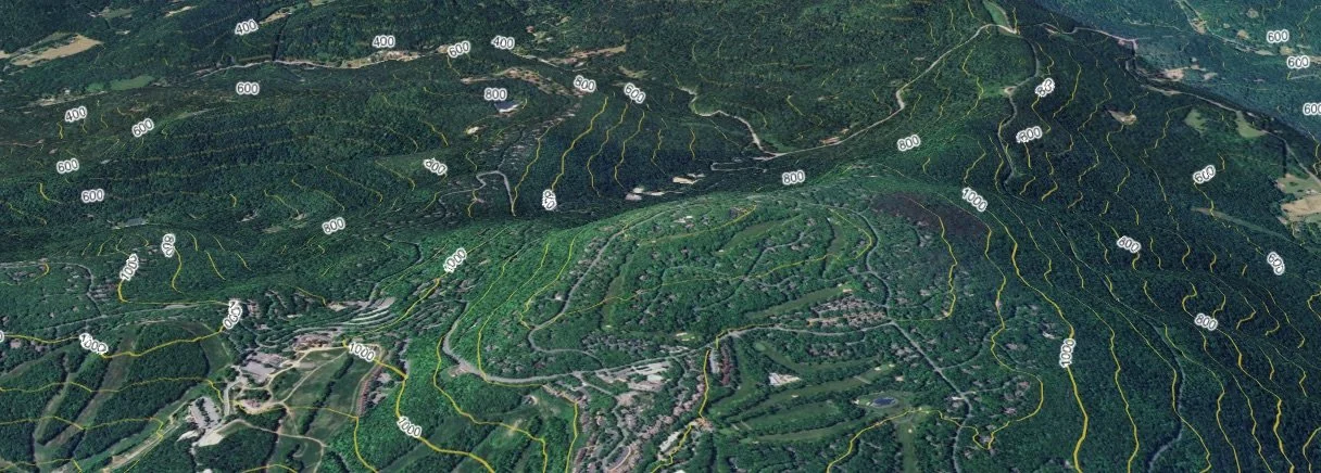
Oblique digital view (from the south) of Devils Knob and the surrounding area at Wintergreen. The cliffs along the southern rampart of Devils Knob are composed of basaltic greenstone that were once lava flows.
What would we encounter in the subsurface if we drilled a scientific research well into the Earth at the Devils Knob highpoint, from the top down?
“Last summer, my research team from William & Mary started conducting fieldwork to compile a new and detailed geologic map of the Wintergreen area.”
Until that hole is actually drilled, we can only surmise what would be encountered in the subsurface, but based on our recent geological mapping at Wintergreen, we can make an informed prediction as to what is below Devils Knob.
Last summer, my research team from William & Mary started conducting fieldwork to compile a new and detailed geologic map of the Wintergreen area. We’ve still got plenty of work left to do, but have made good progress this winter, as the bedrock is easier to see when the leaves are off the trees. Fieldwork in the Blue Ridge is hard work, sure we hike the trails, but to see all the bedrock exposures, we end up in some tough spots – many of which are also exceptionally beautiful.
This is a simplified geologic map of the Devils Knob/Wintergreen area. The different colors illustrate the geologic units exposed at the Earth’s surface. Much of Pond Hollow is underlain by surficial deposits. Note the big roadcut on the north side of Wintergreen Drive.
Wintergreen Drive ascends through Pond Hollow as it winds its way up to the ridgeline. Much of Pond Hollow is underlain by surficial deposits (shown in yellow on the map), these are primarily boulders that have moved downslope under the motive forces of gravity and/or water. Surficial deposits may only be a few feet thick, but they cover up the bedrock, leaving us to speculate on what lies below. (The ?? on the geologic map illustrates a possible location of a geological contact).
There is a large bedrock outcrop exposed in a roadcut along the north side of Wintergreen Drive in Pond Hollow. This outcrop exposes metamorphosed gritty sandstone and conglomerate containing pebbles of granite, quartz, and feldspar. These rocks are part of the Swift Run Formation(shown in orange on the map) and were deposited before the lavas of the Catoctin Formation (shown in green on the map) had erupted. If one hikes north along the Pond Hollow trail, you’ll walk up the hollow and into progressively younger rocks as you ascend from the Swift Run Formation into the Catoctin Formation.
Take some time to study this simplified map of the Devils Knob/Wintergreen area. Most people can get familiar with the geography by first finding Wintergreen Drive on the map where it winds its way up the mountain.
Now focus on the colors, as each color is a different geologic unit that is composed of different rocks. The green denotes the Catoctin Formation, a distinctive and important geologic unit in the Blue Ridge Mountains.
The rock is primarily a basaltic greenstone that was, some 550 million years ago, erupted as lava flows that flooded over a barren landscape.
These rocks were later deeply buried and metamorphosed to greenstone which is a hard and durable rock. Devils Knob is underlain by the Catoctin Formation, and these rocks are well exposed along the crest of the mountain and in the cliffs on the south side of the mountain.
A fault occurs (but it’s also buried beneath surficial deposits) in the last curve along the road just before it emerges from Pond Hollow.
• The Pond Hollow Fault is an interesting geologic structure. It’s not an active fault, that is to say, it won’t generate earthquakes, but its geometry and tectonic history are hugely significant for Wintergreen. In a future post I’ll discuss what we know about the Pond Hollow Fault and why it’s caused trouble.
For the next mile or so the bedrock along Wintergreen Drive is a gnarled old granite that commonly forms blocky to rounded outcrops. The granite crystallized into rock at great depth and formed more than a billion years ago.
The rocks of the Swift Run Formation (in orange on the map) were originally deposited as gravel and sand upon an erosional surface carved into the much older granitic rocks. This geological contact is an unconformity, and here in the Blue Ridge this contact which separates rocks of vastly different age is referred to as The Great Unconformity.
A geologic cross section illustrating the inferred rock geometry beneath Devils Knob. The red line marks a hypothetical well drilled to a depth of ~1,500’ (460 m). GU- the Great Unconformity.
So, these geologic map relations provide context for predicting what’s beneath Devils Knob. A hole drilled at the summit would like encounter 900 feet (275 m) of Catoctin Formation greenstone then pass into 100 to 250 feet (30 to 75 m) of Swift Run Formation meta-sedimentary rocks.
At a depth of perhaps 1,100 feet (335 m) the hole would transect The Great Unconformity and continue downward into the granitic rocks of the basement complex.
It makes sense to call these rocks the “basement” as they are at the bottom and the oldest rocks in the Blue Ridge region.
How confident am I in my prediction of what’s in the subsurface?
I’m certain the Catoctin Formation is present, and estimate, based off of the geologic map data, that there’s about 900 feet of it beneath Devils Knob. Perhaps a better way would be to apply an uncertainty to that estimate, so how about 900 ± 200 feet?
Chuck Bailey served as the interim director of The Nature Foundation at Wintergreen in 2025.
Water wells in the Virginia Blue Ridge are typically drilled to depths of between 200 to 500 feet deep. There are a few water wells drilled on the northwestern flank of Devils Knob, but none go deep enough to encounter the stratigraphy beneath the Catoctin Formation.
In a future post I’ll consider what we might find if we were to drill a really deep hole. Sure, we’d learn a great deal from a 1,500-foot-deep hole, but what would be discovered from a 2- or 3-mile (10,000 to 15,000’) deep hole beneath the Blue Ridge?